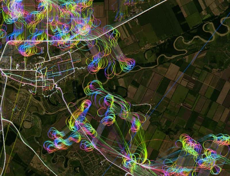
(Image: Eric Fischer/Mapbox)
A crop-dusting aircraft’s graceful, looping route over Russian farmland is tracked by the pilot’s GPS, resulting in a beautiful map you won’t see anywhere else.
This aerial concoction is one of many by custom map-maker MapBox, which has developed a way to overlay the world’s largest trove of open-sourced GPS data – submitted over nine years to the free wiki Open Street Map – on top of aerial imagery to create beautiful, traveller-friendly maps.
Advertisement
Mapbox’s GPS routes are colour-coded by the course of travel, with each direction given its own hue, to help future users verify one-way streets, roads not displayed on traditional maps or, in this case, display one aircraft’s vivid rainbow path across the sky.