(Image: NOAA)
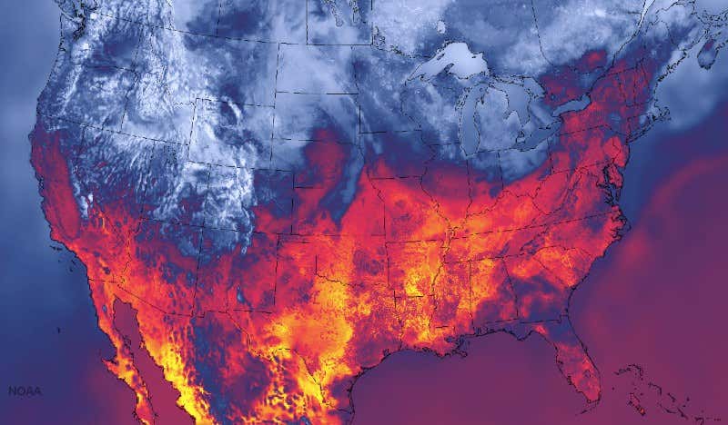
Look out, South Dakota and Nebraska – wild weather is on its way. That’s the message from this example of the new super-detailed US weather forecast map, produced by the National Oceanic and Atmospheric Administration.
NOAA is combining detailed real-world weather data with models of how clouds and winds evolve, creating a weather prediction that is updated every hour. It has a resolution of 3 kilometres, four times better than previous systems. This allows meteorologists to pinpoint neighbourhoods under threat of tornadoes, snowstorms and flash flooding as well as alert airports and pilots to air turbulence and thunderstorms.
Advertisement
The image above, produced on 30 September, appears to show the south of the US ablaze, but it’s actually a map of surface temperature. It shows a cold front moving across the plains, threatening South Dakota and Nebraska with severe downpours.
For more on our planet’s tempestuous climate, read our Instant Expert guide to extreme weather.
Topics: